Services
Advanced Geo & Hydro Survey Solutions
Complete Geophysical & Survey Services
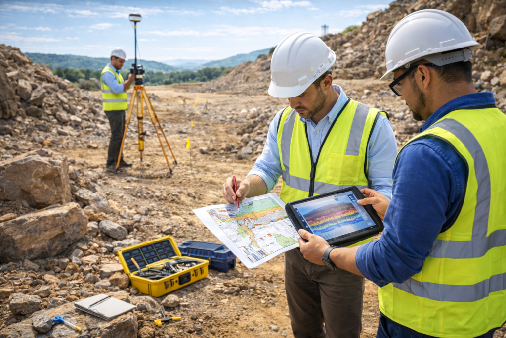
We provide professional geological and hydrogeological survey services using advanced technologies such as Ground Penetrating Radar (GPR), DGPS surveying, drone mapping, and soil testing. Our expert team helps identify underground water sources, analyze soil conditions, and support construction and infrastructure projects with accurate and reliable field data.
Advanced Groundwater Detection Technology
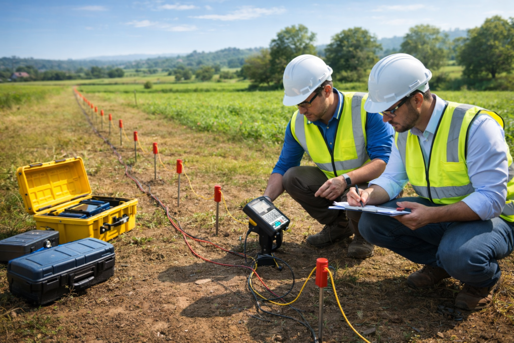
Ground Water Survey
We provide professional groundwater survey services to accurately identify underground water sources for borewells, agriculture, and construction projects. Using advanced geophysical methods and resistivity testing, our experts analyze subsurface conditions to determine the best locations for drilling. This helps improve borewell success rates while saving time and investment.
- Ideal location selection for borewell drilling
- Accurate identification of underground water sources
- Scientific geophysical survey methods
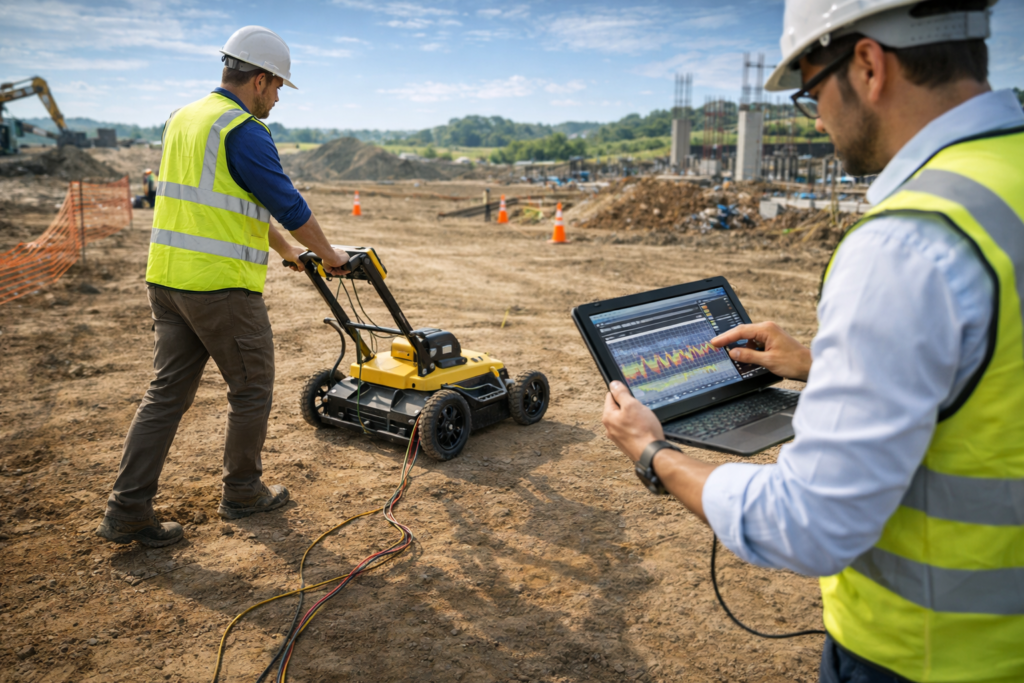
Advanced Underground Detection Technology
GPR Survey (Ground Penetrating Radar)
Our Ground Penetrating Radar (GPR) survey services use advanced non-destructive technology to scan and analyze underground structures. This method helps detect buried utilities such as pipelines, cables, voids, and structural elements before construction begins. GPR surveys improve safety, reduce excavation risks, and provide accurate subsurface data for engineering and infrastructure projects.
- Detect underground pipes, cables, and utilities
- Identify voids and hidden structural elements
- Non-destructive and highly accurate scanning
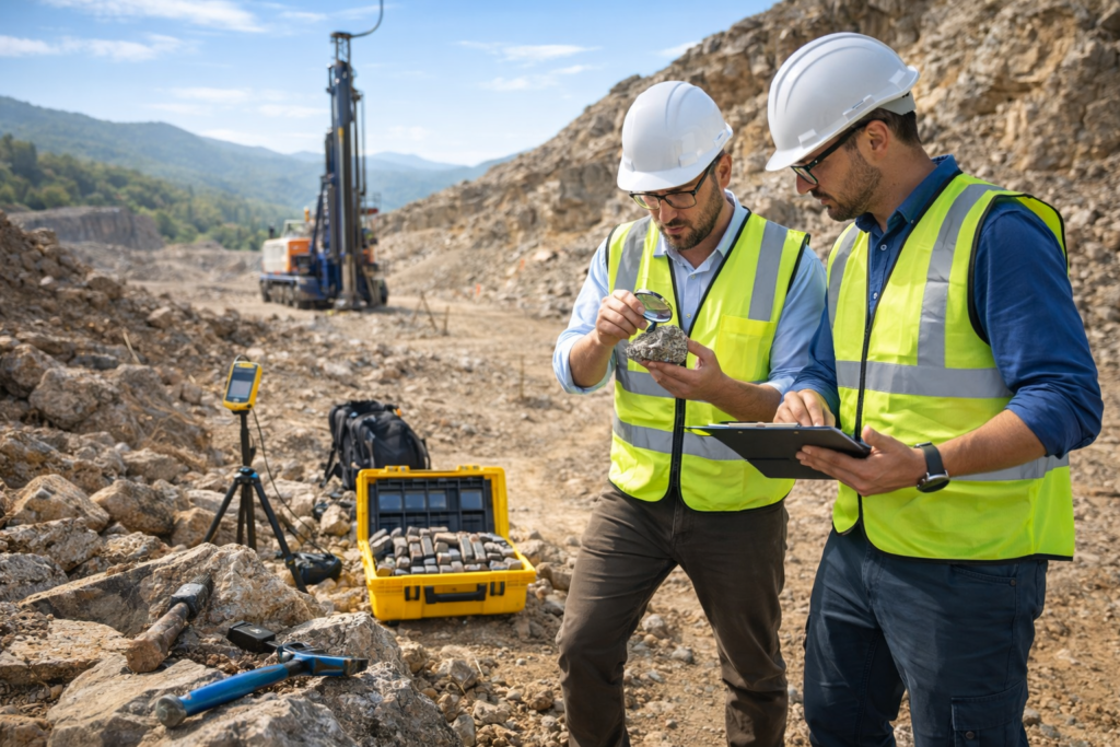
Advanced Geological Investigation
Mineral Exploration
Our mineral exploration services help identify valuable minerals and geological formations beneath the earth’s surface using advanced geophysical survey techniques. We analyze subsurface structures, rock formations, and mineral deposits to support mining, construction, and land development projects. Our scientific approach provides reliable geological data for efficient resource exploration.
- Identification of mineral deposits underground
- Advanced geophysical survey techniques
- Geological analysis of subsurface formations
Accurate Subsurface Structural Analysis
Structural Mapping
Our structural mapping services help identify underground structures and geological formations that are critical for engineering and construction projects. Using advanced geophysical survey techniques, we analyze subsurface layers to detect faults, rock formations, cavities, and structural variations. This data helps engineers and developers plan safe and efficient construction projects.
- Accurate mapping of underground geological structures
- Identification of faults and subsurface formations
- Supports safe construction planning
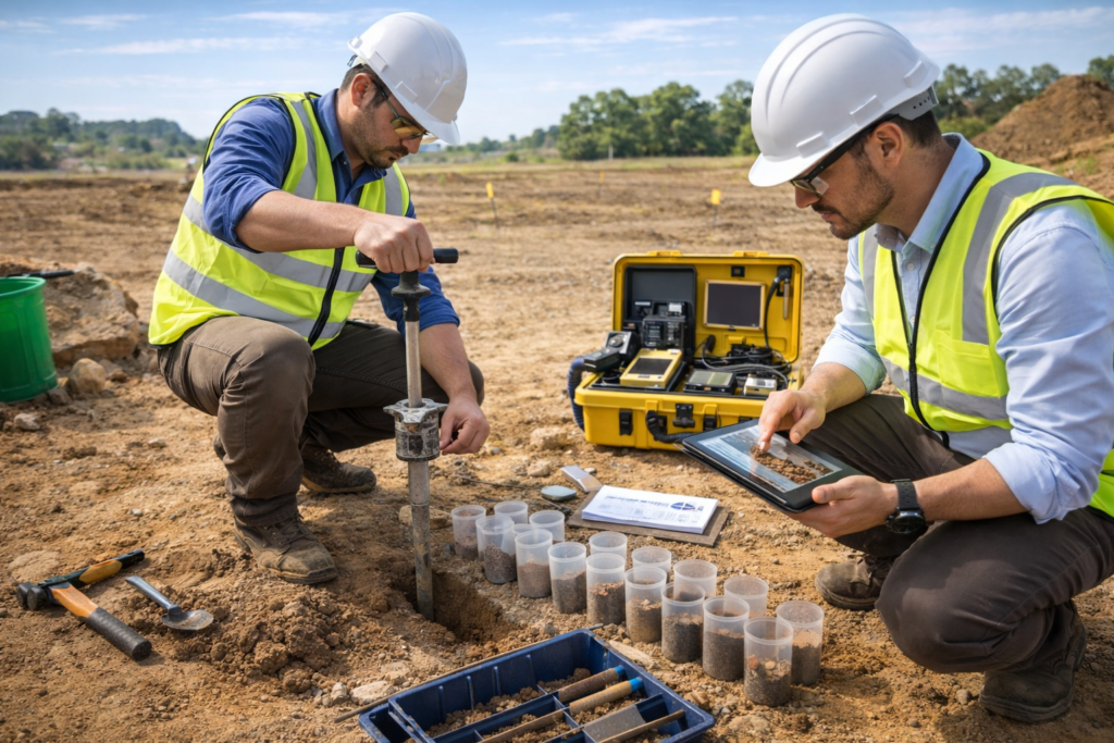
Accurate Soil Analysis for Better Foundations
Soil Testing
Our soil testing services analyze the physical and chemical properties of soil to determine its strength, composition, and suitability for construction and agricultural purposes. Using advanced testing methods, we evaluate soil stability, resistivity, moisture content, and bearing capacity to support safe building foundations and efficient land development.
- Determines soil strength and stability
- Identifies soil composition and moisture levels
- Helps design safe building foundations
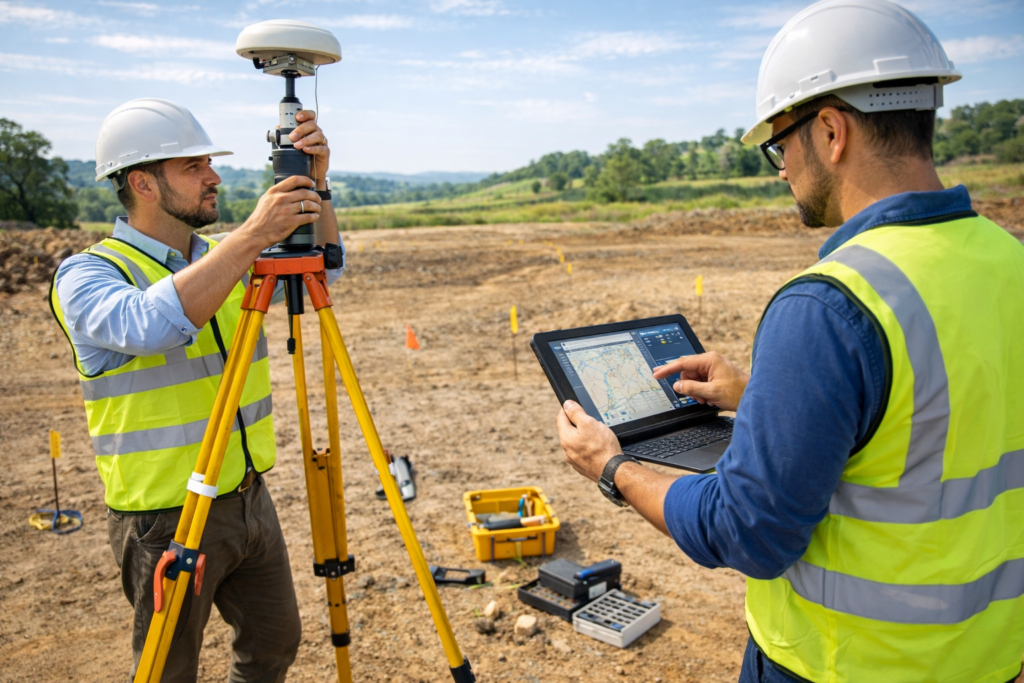
High-Precision Land Survey Technology
DGPS Survey
Our DGPS (Differential Global Positioning System) survey services provide highly accurate land measurements and geographic data for engineering, construction, and infrastructure projects. Using advanced satellite-based positioning technology, DGPS surveys deliver precise mapping, boundary identification, and topographic data essential for planning and development.
- High-precision land measurement and mapping
- Accurate boundary and location identification
- Reliable data for construction and infrastructure planning
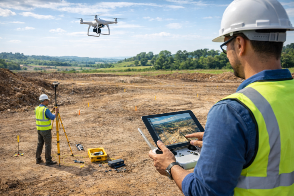
Advanced Aerial Mapping Technology
Drone Survey
Our drone survey services provide fast and accurate aerial mapping for land analysis, construction planning, and infrastructure development. Using high-resolution cameras and advanced GPS technology, drones capture detailed images and geographic data from above, helping engineers and developers make better planning decisions.
- High-resolution aerial land mapping
- Fast and efficient survey of large areas
- Accurate geographic and topographic data
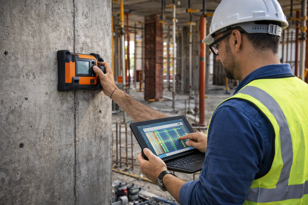
Advanced Structural Detection Technology
Concrete Scanning
Our concrete scanning services use advanced non-destructive testing technology to detect hidden elements inside concrete structures. Using specialized scanning equipment, we identify reinforcement bars (rebar), pipes, electrical conduits, and voids before drilling or cutting. This helps prevent structural damage and ensures safe construction and renovation work.
- Detect reinforcement bars and embedded utilities
- Identify pipes, cables, and hidden objects inside concrete
- Prevents damage during drilling or cutting